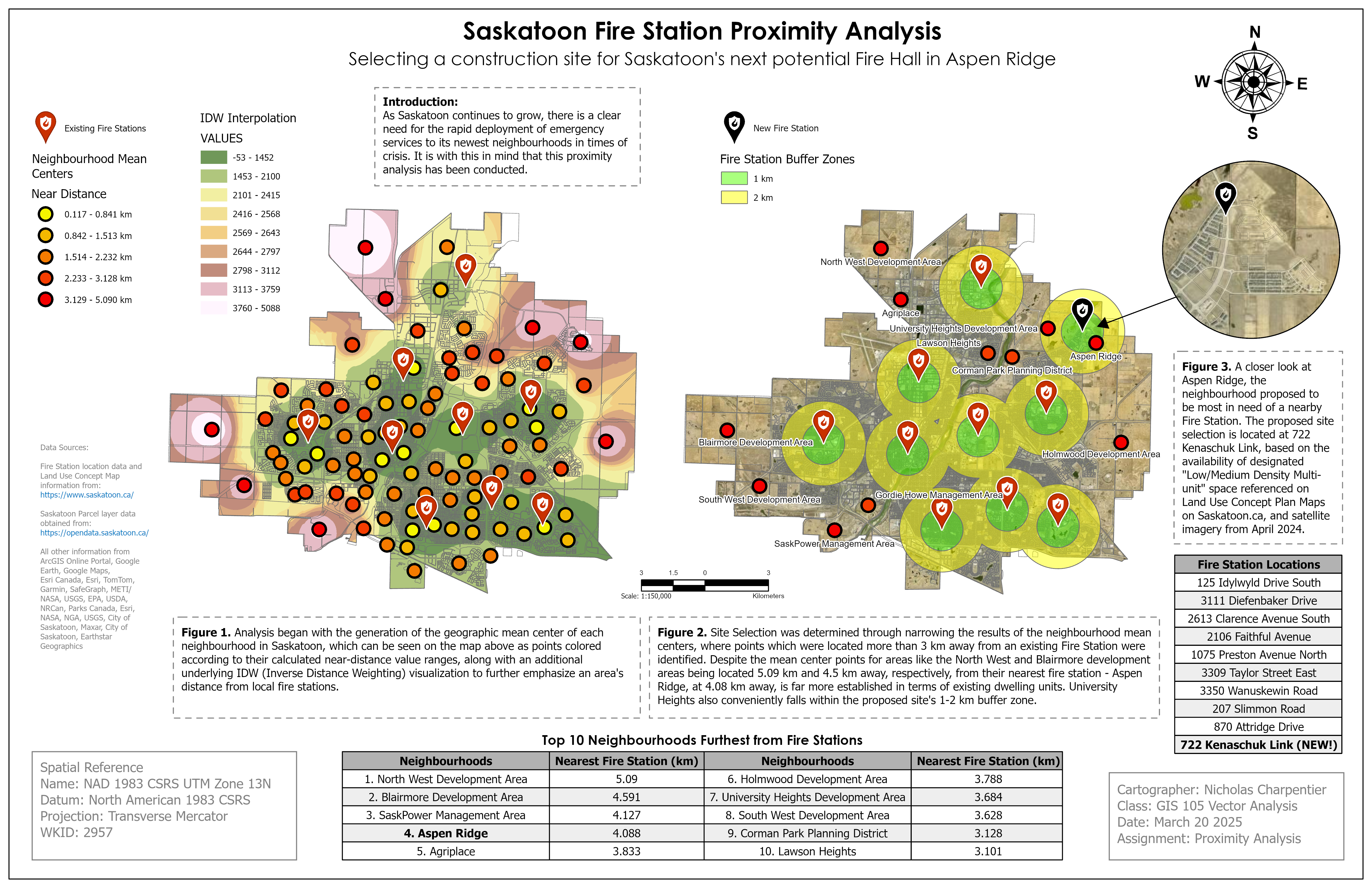
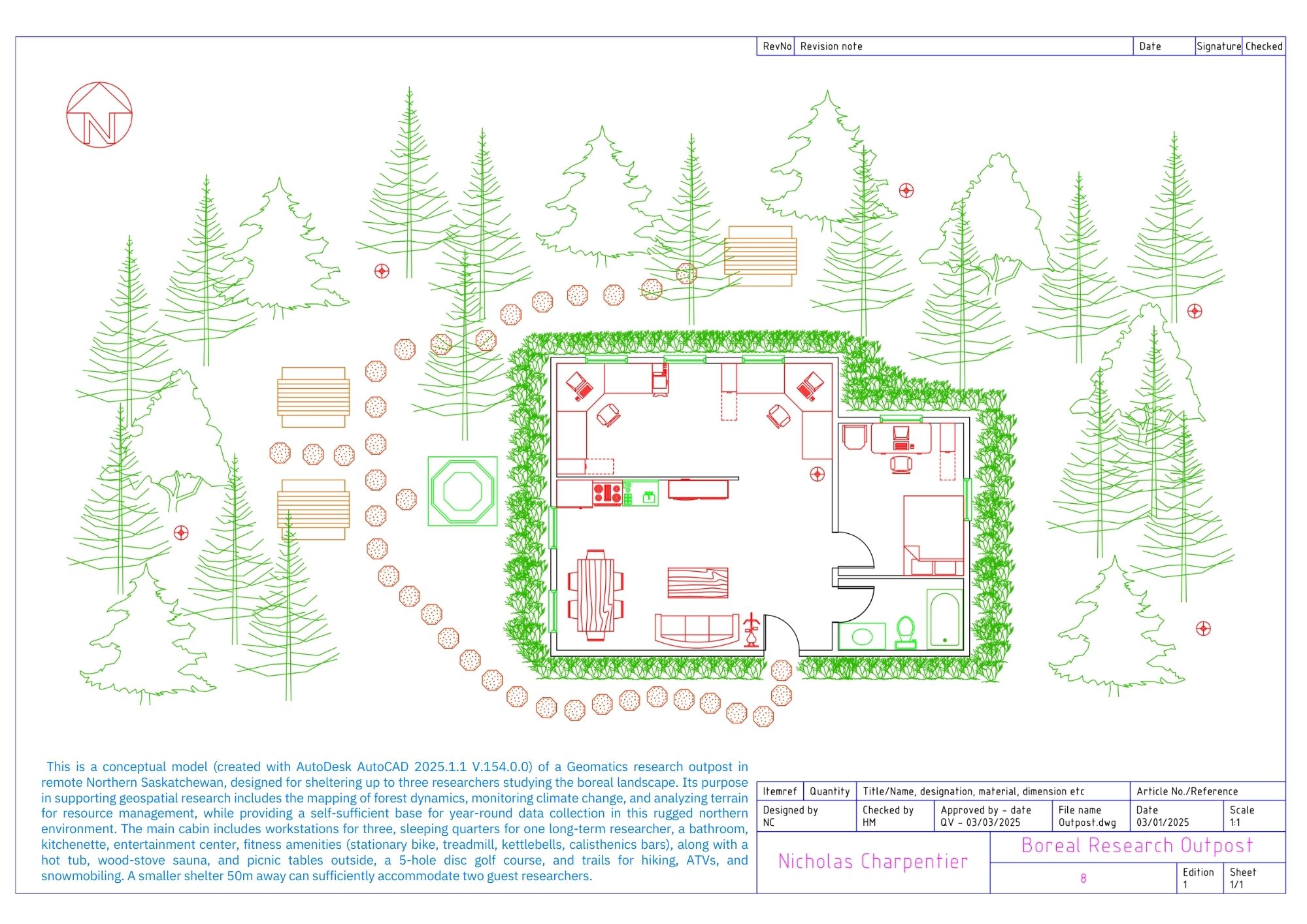
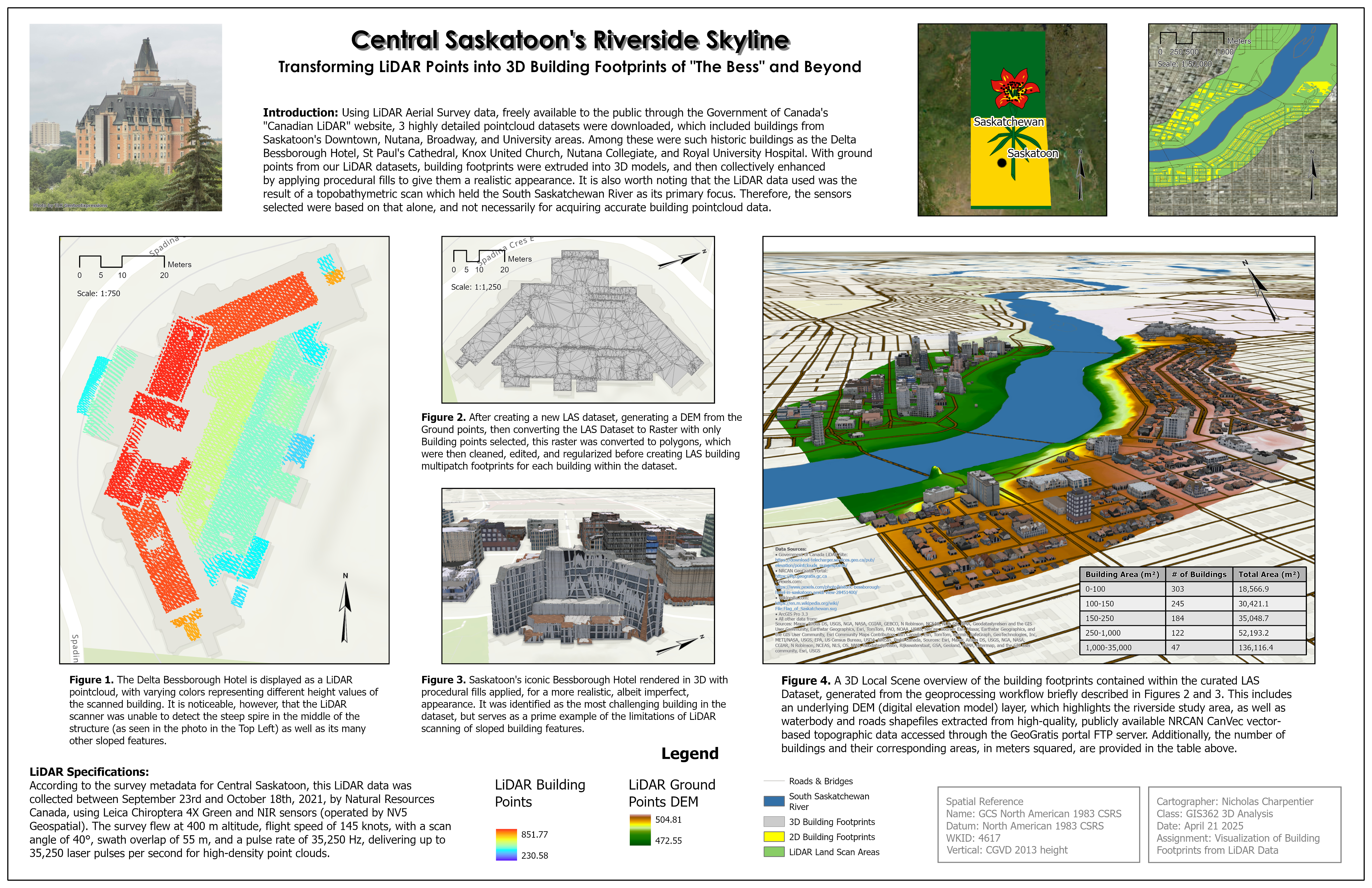
GIS Professional

Certified Drone Operator


about

Nick Charpentier is a Geographic Information Systems (GIS) Professional, certified Drone Operator, and organizational ArcGIS Administrator based in Saskatoon, Saskatchewan.

His interest in mapping and spatial technology grew from a long-standing fascination with aviation, navigational systems, wildfire activity, location-based web development, programmatic automation, and exploration of remote landscapes within the Canadian wilderness and other diverse environments around the world.

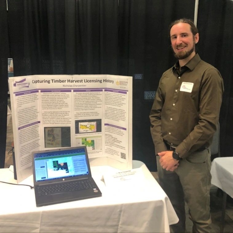
He is a 2025 Esri Canada GIS Scholar whose work focuses on geospatial data workflows, database management, and the integration and analysis of remote sensing imagery and LiDAR data, to better capture, understand, and reveal patterns of geographic change made uniquely visible from an aerial perspective.

This portfolio highlights selected map layouts and GIS projects that demonstrate practical implementation of geospatial systems, spatial analysis, and applied cartographic design.


gis map layouts


studies

Geographic Information Science:
  • GIS Certification from Saskatchewan Polytechnic (2024-2025; Graduated with Great Distinction)
  • Recipient of the 2025 ESRI Canada GIS Scholarship for research and presentation on:
    “Visualizing Controlled Airspace with Augmented Reality”

  • View the 8-minute video presentation here, on SaskPolytech.ca

Click the window above to visit the video presentation site.


Click the window above to visit the ESRI Canada GIS Scholarship site.

  • 72 ESRI Academy ArcGIS Training Certificates (2024-2026)
  • ArcGIS Pro & QGIS: geospatial data analysis (vector, raster, LiDAR, 3D), database design and management (incl. FTP client data transfer)
  • Organizational ArcGIS Online Administration
  • ArcGIS Online applications: StoryMaps, Dashboards, Survey123 Connect XLS forms (incl. dynamic JS calculations), Field Maps, Experience Builder, GeoHub development

Certified Drone Operator:
  • Transport Canada Pilot Certificate - VLOS Basic Operations (2024)
  • NAV Drone flight planning, DJI Fly app, Map Pilot Pro
Remote Sensing:
  • Drone2Map & WebODM image processing, LiDAR data processing, Mosaic datasets
  • Raster functions, Image Analyst geoprocessing
  • Deep learning and GeoAI frameworks - pre-trained models; custom models training
  • Satellite-derived change detection and classification workflows
  • Microsoft Planetary Computer STAC
  • World Imagery Wayback, Landsat & Sentinel EO Explorer apps, NASA Worldview, Copernicus browser
Programming, Automation, Web Development:
  • ArcGIS Notebooks, ArcPy (Python), Arcade, XML, SQL, R, ModelBuilder geoprocessing
  • Python custom geoprocessing script tool creation in ArcGIS Pro
  • HTML, CSS, Javascript, Bootstrap, PHP, Wordpress CMS Custom Theme Development, GitHub versioning
Other Technical Skills:
  • Interpretation of large-scale maps (Topographic, RM, VFR, and Forest Stand Type)
  • Large Format Plotters: map production and basic maintenance.
  • AutoCAD, Blender 3D, Project Management Software (Monday.com), Google Earth Studio, Avenza Maps, REDapp (FireWI/FireBP Calculator), RTK-GNSS and Garmin GPS receivers
  • MS Office 365 applications: Excel (incl. VBA macros), Word, SharePoint, Teams, Outlook, PowerPoint
Education:
  • Saskatchewan Polytechnic 2024-2025
    (Geographic Information Science Certification)
  • Saskatchewan Polytechnic 2013-2015
    (Medical Device Reprocessing Certification)
  • University of Saskatchewan 2006-2011
    (Geomatics & Psychology Undergraduate Coursework)


contact info


Professional Inquiries welcome via eMail or LinkedIn